Photos taken by the US Geological Survey. For the full folder of photos, check out the USGS website.
072. Santa Cruz’s town clock stopped a few minutes after the earthquake.

073. Pacific Avenue. Brick buildings were a serious liability.
074. Pacific Avenue
075. Pacific Avenue. Yes, our town really looked like this.
076. Some businesses never returned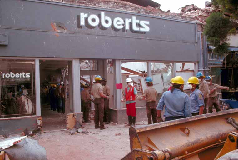
077. People were injured and killed in downtown SantaCruz. Rescue operations started almost after the quake.
078. Many of our older buildings were lost. Our Downtown/Pacific Avenue commercial area had been listed as a historical district, but is was delisted by the National Register of Historic Places because of the earthquake’s effects.
079. Businesses had to abandon their shops. Many set up in tents — and operated in tents for years after the quake.

080.
082. The levee by the river shows rifts
083. Hillsides collapsed
088. Ford’s department store in downtown Santa Cruz never reopened
063. The Santa Cruz Mountains saw incredible destruction
055. 
092. Watsonville, too, experienced massive damage to beautiful old buildings

094. Highway 1 heading south from Watsonville
006. In San Francisco, many buildings had even more dramatic collapses
009.
Attributions for all these photos and more: